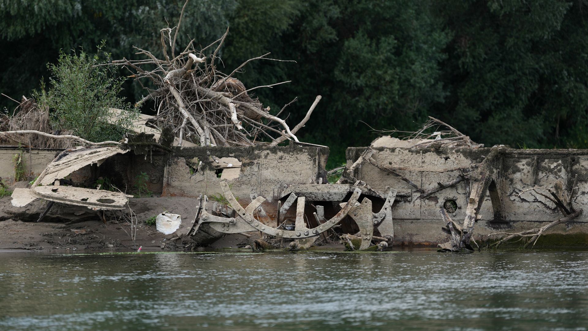
Severe hydrological depletion across continental river networks acts as an unsparing diagnostic tool for civil infrastructure and historical preservation. When persistent meteorological drought drops water tables in major European basins to multi-decade lows, the exposed riverbeds do not merely display dry earth. They reveal a physical ledger of past climate states, structural engineering failures, and lost economic routes. Analyzing these exposed sites requires moving past superficial observations of receding shorelines to examine the systemic vulnerabilities of water resource management and the permanence of material culture submerged in freshwater environments.
The Hydrological Mechanism of Riverbed Exposure
Receding water levels in systems like the Danube, the Po, and the Rhine expose submerged objects through a predictable degradation of volume and flow rates. This process follows a strict downward trajectory driven by precipitation deficits and prolonged thermal anomalies.
The primary driver is an imbalance in the hydrological budget. When upstream snowpacks fail to accumulate during winter and high-pressure atmospheric blocks prevent frontal precipitation in summer, discharge rates decline exponentially relative to evaporation. As the cross-sectional area of the river diminishes, hydraulic pressure drops, exposing bathymetric anomalies that remain hidden under normal flow regimes.
[Precipitation Deficit + Thermal Anomaly]
       ↓
[Upstream Storage Depletion]
       ↓
[Discharge Volume Collapse]
       ↓
[Hydraulic Pressure Reduction]
       ↓
[Submerged Artifact exposure]
This dynamic exposes two distinct categories of submerged objects: industrial-era transport infrastructure and antiquity-era civil architecture. The simultaneous appearance of both highlights an overlapping vulnerability across centuries of human interaction with major waterways.
Industrial-Era Logistical Failures
The discovery of scuttled or sunken steam vessels from the mid-to-late nineteenth century provides a direct physical record of historical transport economics and logistical collapse. During periods of low water in previous centuries, these vessels frequently fell victim to navigational hazards or intentional abandonment when cargo transit became economically unviable.
Operating a steam-powered paddle or screw vessel on a fluctuating river requires maintaining a precise draft-to-depth ratio. When riverbeds shoal unexpectedly due to upstream siltation or sudden drought, vessel hulls encounter unmapped bathymetric obstacles.
- Draft Constraints: Loaded steamships require a minimum clearance threshold. Falling water depths transform navigable channels into shallow traps.
- Structural Compromise: Wooden or early iron hulls resting on uneven riverbeds experience severe bending moments, often breaking the keel.
- Economic Abandonment: Salvage costs historically outweighed the scrap value of stranded hulls, leading operators to abandon vessels directly in the channel.
The preservation state of these iron and wooden frames depends heavily on sediment burial rates. Anaerobic sediment environments slow oxidation and wood-boring organism activity, allowing structural ribs and propulsion machinery to survive intact for over a century until a new drought cycle exposes them to oxygen.
Antiquity-Era Infrastructure and Climatic Baselines
Further down the material timeline, exposed Roman bridges and masonry piers offer data points for historical hydro-climatic baselines. The construction of stone arch bridges across major European rivers during the Roman imperial period required precise engineering accommodations for seasonal flooding and normal flow baselines.
Engineers of the era built cofferdams, drove timber piles into the alluvial bed, and poured hydraulic concrete foundations. The presence of these structures in the middle of current riverbeds indicates that hydrological baselines have shifted significantly over two millennia. Either the contemporary river channel has widened, or the historical mean discharge was lower, or anthropogenic channel modifications over centuries have concentrated and deepened specific flow paths while starving others.
- Foundation Engineering: Timber pile fields driven beneath stone piers rely on permanent water saturation to prevent fungal decay and insect infestation.
- Channel Morphology: The survival of these piers proves that riverbanks are dynamic, shifting laterally across floodplains over long temporal scales.
- Climatic Variance: The architectural footprint demonstrates that extreme drought phases are recurrent historical phenomena rather than unprecedented contemporary aberrations.
When these foundations emerge, they signal that the water table has fallen below the minimum operational thresholds established during the construction phase. This exposes the timber elements to rapid aerobic degradation, threatening the structural integrity of archaeological sites that survived centuries of underwater protection.
The Economic and Operational Cost Function
The emergence of sunken steamboats and ancient stone piers carries immediate operational consequences for modern commerce and civil administration. Inland waterways function as high-efficiency freight corridors. When water levels drop sufficiently to expose historical wrecks, those same wrecks transform into navigation hazards for modern commercial barge traffic.
Modern bulk carriers face severe payload restrictions during drought conditions. Operators must lighten their loads by up to thirty percent to clear shallow bars and newly exposed obstacles. This operational constraint spikes the cost per ton-mile, forcing freight shippers to divert cargo to rail and road networks that lack the capacity to absorb sudden modal shifts without congesting supply chains.
Municipalities managing municipal water extraction face parallel challenges. As riverbeds dry, intake pipes situated near historical bridge alignments or abandoned industrial sites risk drawing in contaminated sediment or becoming completely unwatered. The remediation strategy requires immediate dredging and structural reinforcement, turning emergency conservation measures into capital-intensive engineering projects.
Resource Allocation for Archaeological Salvage
Heritage management agencies face a compressed operational timeline when drought reveals submerged assets. Submerged wood and iron begin to degrade within weeks of exposure to atmospheric oxygen and fluctuating humidity.
- Documentation Phase: Rapid photogrammetry and laser scanning must capture spatial data before surface cracking destroys delicate surface features.
- Extraction vs. In Situ Preservation: Lifting large iron hulls or fragile timber structures requires heavy crane deployment and immediate chemical stabilization, often exceeding regional municipal budgets.
- Triage Protocols: Agencies prioritize sites based on historical uniqueness, structural vulnerability, and the degree of active vandalism risk once the site becomes accessible by foot from the exposed riverbank.
Uncontrolled public access to exposed riverbeds presents a direct threat to archaeological integrity. Unauthorized artifact recovery strips context from historical sites, converting valuable structural data into private curiosities.
Deploy continuous remote-sensing bathymetric surveys across all major commercial river networks during normal flow regimes to map sub-surface anomalies before drought exposure occurs. Integrate these hydrographic maps with regional freight routing algorithms to dynamically adjust barge draft limits and prevent groundings on historical obstructions long before water tables reach critical depletion thresholds.


